Maps of the Glasgow Subway
Here you’ll find a range of visual interpretations of the Glasgow Subway route. From the historical, to the eye catching, there’s a map here for everyone’s taste. Whether you’re a tourist or a local just pick your favourite, print it off and stick it on your fridge.
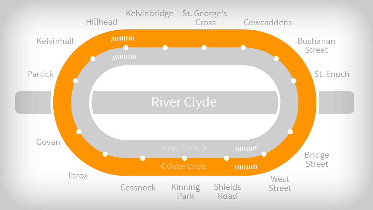
Our animated map
We decided the original SPT map was getting a bit tired so we decided to do this funky new animated version. Believe it or not we really had to think which way the trains went round. Think about it.
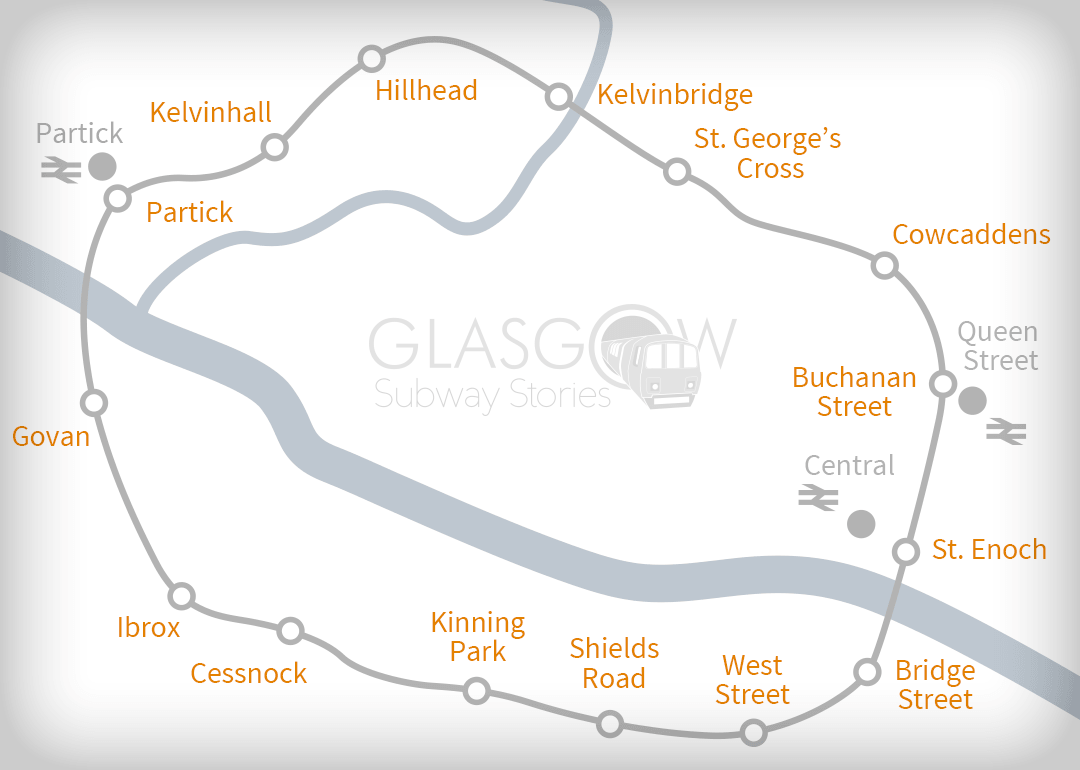
Geographical Map
This map gives you a basic idea of the geography surrounding the subway line. The main feature being the River Clyde, which is that thick line that cuts the map across the middle. This allows you to see at a glance which station are south of the river for example. We have also included the locations of three of the most important train stations in Glasgow. Namely: Queen Street Station, Central Station and Partick Station.
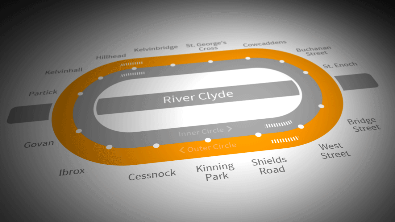
3D Map
I must say we’re quite proud of this one around here. We feel this stylish 3D map reflects the modernity of the renovated subway system. In a world full of 3D and virtual reality we just couldn’t let our beloved subway be behind the times.
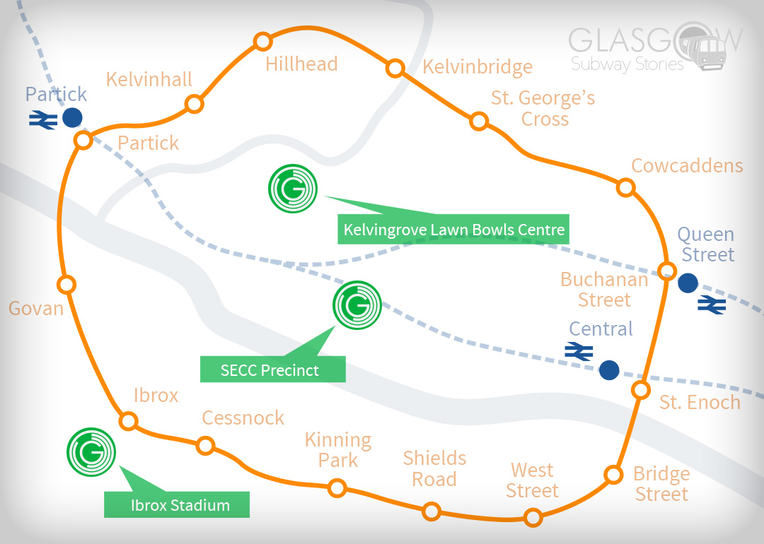
Our Commonwealth Games Map
In 2014, Glasgow was the proud host of the Commonwealth games. Part of its resounding success was the ease with which anyone could reach a particular venue, due in no small part to our subway system. With that in mind we here at GSS thought it was only appropriate to create a map detailing the most important venues around the city. The map shows the usual subway layout but with the addition of Kelvingrove Lawn Bowls Centre, The SECC and Ibrox Stadium. We hope that we helped athletes and spectators alike find their way around, stress free.
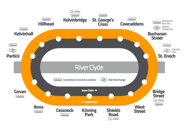
Official Map
This is the official SPT map of the Glasgow Subway. While it serves its purpose well enough, we happen to like ours better! Nonetheless, a useful feature of this map is that it provides information on which stops have bus connections, rail interchanges and park and ride facilities. All very handy if you’re travelling across Glasgow. However, Let it be said here in general SPT provide an excellent service and are to thank for our subway system in the first place.
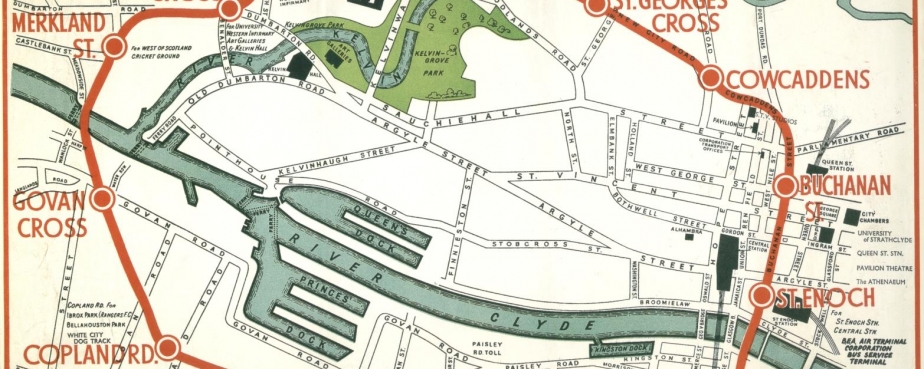
Historical Map
This is actually the original map of the Glasgow Subway system. This one ha a number of interesting features that go beyond its charming, vintage look. Firstly, the map provides a bit of history, offering a snapshot of Glasgow at the time. Secondly,the map puts the subway in the context of the surrounding streets and areas, helping you get a real feel for the area as well a knowledge of where to get off for what. Furthermore, the eagle eyed among you may have noticed a few of the original stations no longer exist. These are Merkland Street and Copland Road, both of which were shut down in 1977 as part of the modernisation process. They have since been replaced by Kelvinhall and Ibrox respectively.

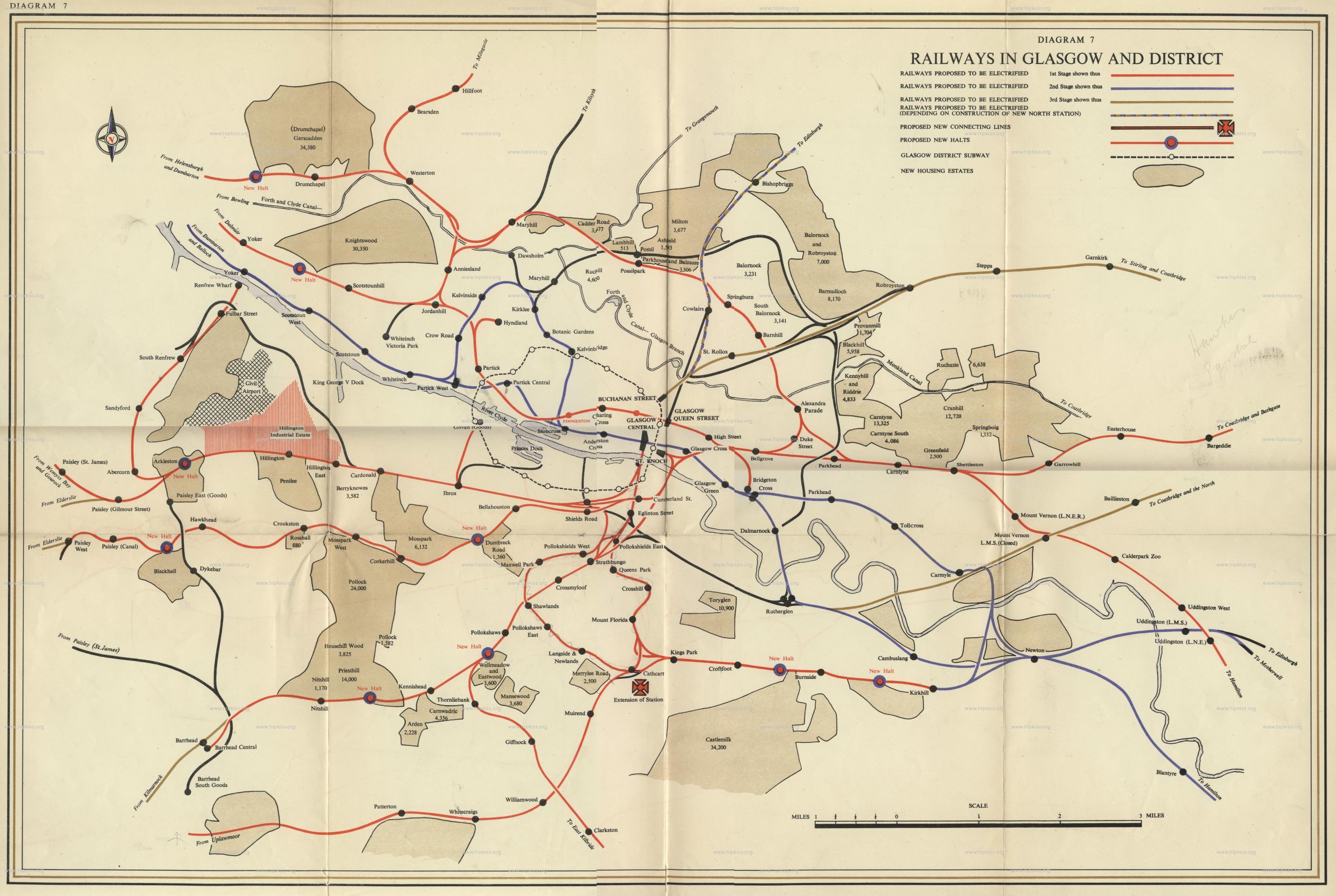
Glasgow Rail Map
This map is ideal for anyone who wants to gain a more in depth knowledge of the role that the Glasgow Subway system plays, in the wider rail network of Glasgow and its surrounding areas. The subway route on this map is the dotted line that forms a circle, slightly to the left of the centre of the map. Making up the rest of the map is a full account of the available rail networks in the subway’s vicinity. Anyone planning a trip consisting of a subway journey followed by a train, would do well to consult this map.
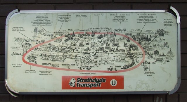
Visual Map
This map takes me back to my childhood. In it’s day this was cutting edge 3D technology and I vaguely remember being quite impressed by it. The ability to actually see the buildings and geography of the surrounding area, is indispensable in trying to build up a picture of how the subway links in with the city. If you’re looking to get a fully rounded idea of how the subway fits into the rest of the city, this map is ideal.